|
We're keeping an eye on Wednesday afternoon and overnight into the early hours of Thursday morning. As of late Monday evening, The NWS Storm Prediction Center has put the northern part of the area in a SLIGHT risk, while areas south Interstate 40 are in the ENHANCED risk. The main threats are damaging winds in excess of 60 mph, flash flooding, and an isolated tornado. The threat of large hail remains on the low end. Timing looks to be concentrated from 3pm EDT Wednesday to around 2am EDT Thursday. As of late Monday evening, models have been suggesting a line of discrete supercells across the area around the evening hours (6-9pm EDT Wed). If the trend continues, the SPC may increase the tornado and damaging wind potential. After most of the rain ends, the center of the low pressure will begin to make its way through the area. Wind will pick up through the night and may blow around unsecured objects. This is a developing situation, as we get closer to the event, more details will follow as we are able to fine-tune the forecast. Stay with East Tennessee SkyWatch and Appalachian Highlands Weather. We'll keep you advised. Follow East Tennessee Skywatch and Appalachian Highlands Weather on Facebook and Twitter! 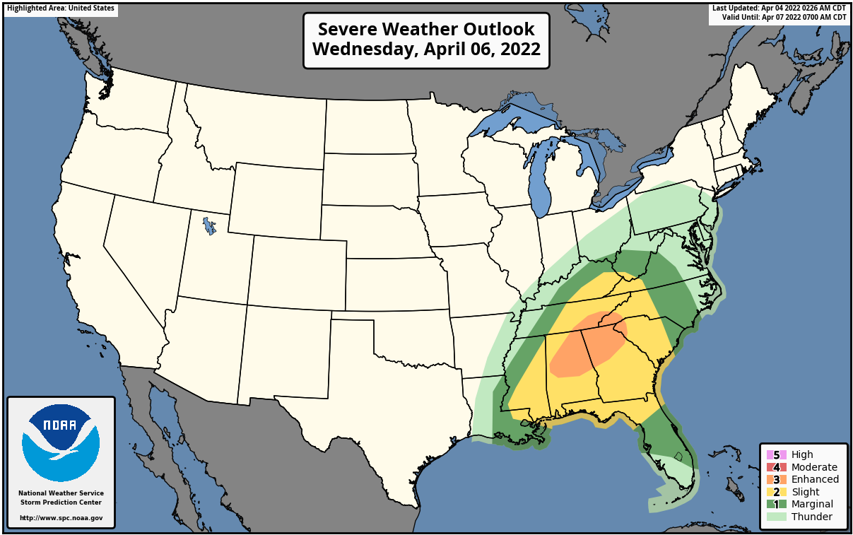 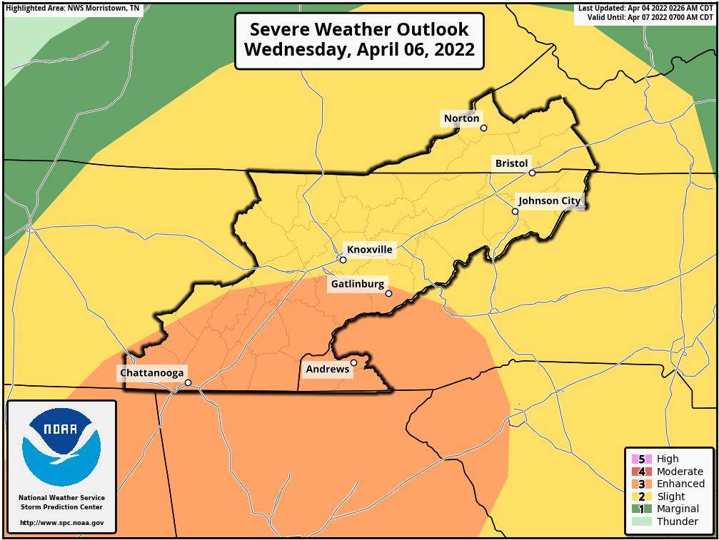
0 Comments
|
AuthorEast Tennessee SkyWatch Archives
May 2023
|
 RSS Feed
